
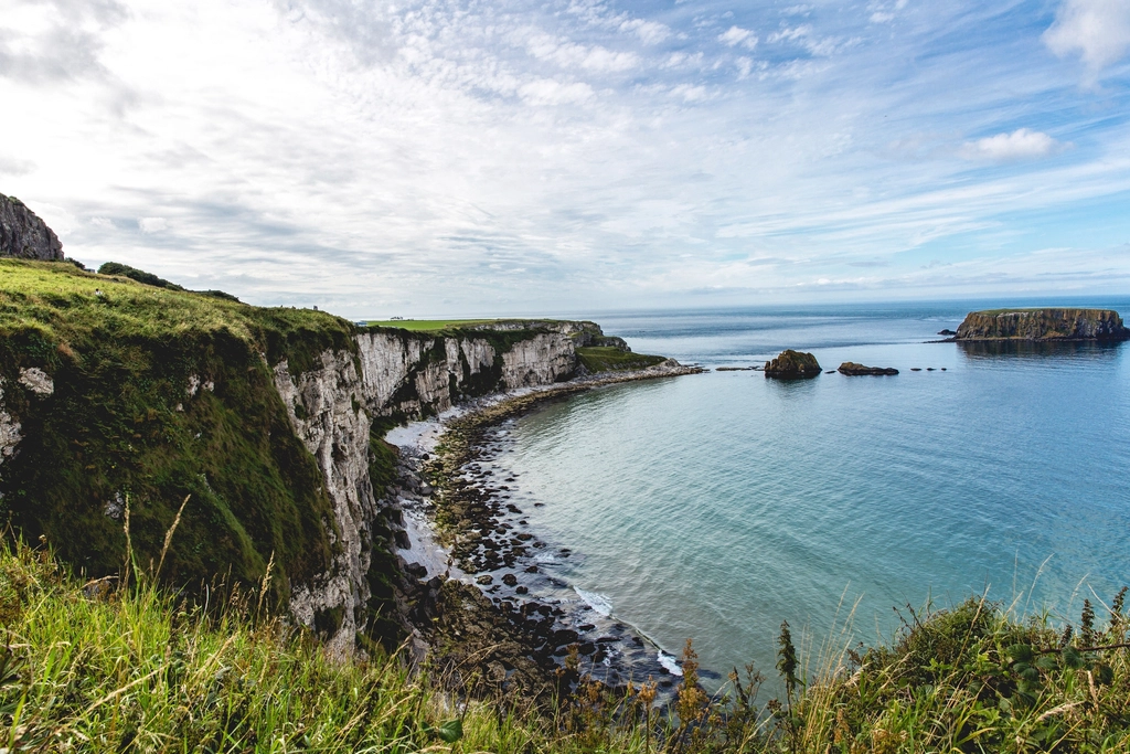
The road round Slea Head, and why it rewards patience
From Tralee, the Dingle Peninsula is the nearest of Kerry’s great headlands and, for a lot of visitors, the one that stays with them. It is a narrow finger of land running west into the Atlantic, ending at Slea Head and the cluster of drowned hills called the Blaskets. The road that circles its western tip is one of the most photographed stretches of tarmac in Ireland, and it is also one of the most commonly rushed. People leave Tralee after breakfast, drive the loop in ninety minutes, buy an ice cream in Dingle and drive home. It works. It is also a waste of a day that could have been remarkable.
Getting there from Tralee
There are two ways west. The main road runs through Camp and Anascaul and along the south side of the peninsula into Dingle town — wider, faster, and perfectly pleasant. The other is the Conor Pass, which climbs steeply out of the valley behind Cloghane and drops into Dingle from the north. The pass is spectacular in clear weather and genuinely narrow in places, with rock on one side and a long drop on the other. It is not the place to discover that your hire car is wider than you thought. Larger vehicles are restricted, and in low cloud you will see nothing but the wall beside you.
A reasonable compromise is to go out by the main road, do the Slea Head loop, and come back over the pass in the late afternoon when the light is better and the traffic has thinned. If the cloud is down, take the main road both ways; the pass in fog is a stressful drive with nothing at the end of it.
One direction, and the reason it matters
The Slea Head Drive is signposted as a loop from Dingle town, and the convention is to drive it clockwise, heading west along the south coast through Ventry towards Slea Head, then round the tip and back along the north side through Ballyferriter and Gallarus. Tour buses follow that direction. So should you.
This is not fussiness. Long sections are single-track with passing places, cut into a steep slope with a stone wall on the seaward side. Meeting a coach head-on means one of you reverses, and it will not be the coach. Going with the flow removes most of the difficulty from the drive.
Driving habits that help
- Use the pull-ins, not the verge. Stopping on the road itself to take a photograph is the single most common cause of jams on the loop. There are marked pull-ins at most of the good views; use them, and if one is full, carry on to the next rather than inventing a space.
- Expect farm traffic. This is working land. Tractors, sheep and slow-moving machinery are normal, and the animals have right of way in practice if not in law.
- Give yourself half a day at minimum. The loop is only around fifty kilometres, but with stops it fills four to six hours comfortably. Treating it as an hour’s drive means seeing very little of what you came for.
- Watch the sky, not just the forecast. Conditions on the peninsula change within the hour. A grey morning often clears by two; a bright morning can close in by eleven. Keep the day flexible rather than fixed.
The beehive huts and what they actually are
Along the road west of Ventry you will pass signs for clochans — the drystone beehive huts that are among the most recognisable structures in Kerry. They are corbelled, meaning each ring of stone sits slightly inside the one below until the walls close at the top, with no mortar anywhere in the building. Several clusters sit on private farmland, and the landowners charge a small fee to walk in.
How old are they?
Be aware that the dating of these buildings is genuinely uncertain and contested among archaeologists. Some are early medieval; others are far more recent field structures built in the same technique, because it was a good technique and the stone was there for the lifting. Interpretation panels at some sites are more confident than the evidence warrants. That does not make them less worth seeing, but treat firm claims about specific centuries with mild scepticism.
Gallarus Oratory
On the northern side of the loop, inland from Ballydavid, stands the best-known drystone building in Ireland. Gallarus Oratory is a small boat-shaped chapel built of unmortared stone, with a single doorway at the west end and a narrow window facing east. It has stood, essentially intact and essentially dry, for a very long time, and that is the thing that impresses people most once they are standing inside it with the Atlantic weather going on outside.
Its date is also debated, with estimates spanning several centuries of the early medieval period. The building itself does not care. It takes ten minutes to look at properly. Go early or late if you can; a single coach party fills the interior completely, and the interior is most of the point.
Coumeenoole, Dunquin and the western edge
Coumeenoole is the beach you have seen in photographs of the peninsula without knowing its name — a wedge of sand at the bottom of a steep grassy slope, framed by dark rock, with the Blaskets sitting offshore. There is parking above it and a path down. It is a magnificent place to stand and a poor place to swim casually: the water is fully exposed, the currents are serious, and there is no lifeguard cover for most of the year. Treat it as a viewpoint rather than a bathing beach.
A little further round is Dunquin, in Irish Dun Chaoin, the westernmost settlement on the mainland. Its harbour is famous for the zig-zag concrete path that switchbacks down the cliff to a tiny landing, built for the Blasket islanders and their boats. Walking down is easy; walking back up is a real climb, and the path is sometimes closed or restricted when its condition or the weather requires it. Check locally before you commit to the descent.
Language and place names
The western end of the peninsula is a Gaeltacht — an area where Irish is a community language, not a heritage exhibit. Road signs west of a certain point are in Irish only, which catches out drivers relying on English names. Dun Chaoin is Dunquin; Ceann Tra is Ventry; An Daingean is Dingle. Load offline maps before you set out; the mobile signal drops repeatedly along the western cliffs.
The peninsula out of season
Summer on the Slea Head loop can be genuinely congested, and the narrow sections do not absorb volume well. The peninsula in October, or in a settled spell in March, is a different and in most respects better place: the light is longer and lower, the pull-ins are empty, and Dingle town returns to being a working fishing port with a lot of pubs rather than a queue with a view.
The trade-offs are real. Boat trips largely stop. Some cafes, craft shops and smaller guesthouses close for the winter, and opening patterns vary year to year, so ring ahead rather than assuming. Daylight is short in December and January. And the weather that makes this coast dramatic will also, on a bad day, turn every viewpoint into a grey wall.
If you can only come in high summer, the fix is timing rather than season. Start the loop before nine, or after four. The buses run to a schedule, and the gaps between them are wide enough to have Slea Head almost to yourself for twenty minutes at a time.
Making a day of it from Tralee
A workable shape: leave Tralee early, drive the main road to Dingle, pick up food there because options thin out west of the town, and start the loop clockwise by mid-morning. Stop at Ventry, at Slea Head, at Coumeenoole and at Dunquin, then take the northern side slowly with Gallarus and a quieter strand near Ballyferriter. Return to Dingle for an early dinner and drive back over the Conor Pass if the sky is clear.
That is a full day, and it does not involve hurrying at any point, which on this particular peninsula is more or less the whole trick.