
A long walk that does not have to be walked whole
The Kerry Way is a waymarked long-distance walking route that loops around the Iveragh Peninsula, the big mountainous finger of land that also carries the Ring of Kerry road. It begins and ends in Killarney, and between those points it threads through Kenmare, Sneem, Caherdaniel, Waterville, Caherciveen, Glenbeigh and Glencar before turning back east under the Reeks. Figures for its total length vary depending on which spurs and variants you count, but it is usually described as a little over two hundred kilometres, which puts it among the longest waymarked trails in Ireland.
That length intimidates people unnecessarily. Most walkers on the Kerry Way are not walking the Kerry Way. They are walking two days of it, or five, or a single afternoon stage. The trail was assembled from old roads, farm tracks, forestry roads and mountain passes that people used long before anyone thought of putting arrows on posts, and each of those pieces stands up perfectly well on its own.
What the route actually consists of
Do not picture a manicured path. The Kerry Way is a stitched-together thing, and its character changes from hour to hour. Some of the best sections follow old droving and butter roads — the routes along which farmers once brought stock and produce over the passes towards markets and ports. They run at a gentle, contour-following gradient because they were made for animals and carts, and they are a pleasure to walk: green underfoot, walled on both sides.
Other sections are less romantic. There are stretches of tarmac, sometimes a couple of kilometres at a time, where the route has no option but to use a quiet public road. There are forestry sections on gravel, and boggy open hillside where the path is a trodden line rather than a constructed surface. Walkers who arrive expecting a continuous mountain path come away disappointed.
The high sections and the low ones
The route does not summit anything. It crosses passes rather than peaks, which means the climbing is real but bounded, and it also means you spend a good deal of time in the altitude band where cloud tends to sit. The eastern sections around Killarney and the Black Valley take you into genuinely wild ground beneath the highest mountains in the country. Further west and south, around Sneem and Caherdaniel, the walking is lower and more coastal. Want big country on limited time? Look east. Want sea views and easier days? Look west.
Waymarking, and what happens to it in mist
The Kerry Way uses the standard Irish national waymarking: a yellow walking figure and a directional arrow on a black background, mounted on posts, stiles and occasionally rocks or walls. On a clear day you pick up the next marker from the last one, and the route more or less walks itself.
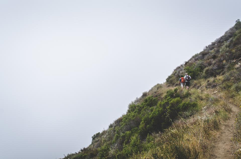
In hill fog it is a different proposition. Markers are placed at intervals that assume you can see a reasonable distance; when visibility drops to twenty or thirty metres, the gaps between them become gaps in your information. This is the most common way walkers get into difficulty here. They follow arrows happily for two hours, the cloud comes down, they lose the thread, and they discover they have not been navigating at all — they have been following signage, which is a different skill.
Carrying real navigation
Treat waymarking as a convenience rather than as your navigation system.
- Carry the paper map for your section. Ordnance Survey Ireland Discovery series sheets cover the peninsula, and larger-scale walking maps exist for parts of it. Work out which sheet you need before you leave town; you will not be buying it on the hill.
- Carry a compass. You do not need advanced technique. Being able to take a bearing off the map and walk it for ten minutes is enough to get you off a featureless shoulder and back onto a track.
- Use a phone app as backup, not primary. Battery drains fast in cold and wet, coverage is patchy in the valleys, and a wet touchscreen becomes unusable. Bring a power bank and keep the phone dry.
- Note your escape options first. Most stages have a point where a track or minor road drops off the route towards a village. Knowing where those are turns a bad-weather day from a crisis into an inconvenience.
- Tell somebody your plan. A text to tonight’s accommodation saying which way you are coming costs nothing and shortens any search dramatically.
Underfoot: wet is the default
Kerry is one of the wettest parts of Ireland, and the ground holds that water. Blanket bog, rushy pasture and peaty hill soil do not drain quickly, so even after a settled dry spell you should expect soft ground on the open sections.
Waterproof boots with ankle support are the sensible choice, worn with gaiters if you dislike wet shins. Trail shoes are fine on road and forestry sections and miserable on bog. Accept that your feet will get wet and carry spare socks in a plastic bag. Poles earn their place here more than on drier trails.
River crossings
Most watercourses are bridged or steppable. A small number are not, and in spate they become genuinely dangerous. The rule is unglamorous: if you would not be confident of staying on your feet, do not cross. Walk upstream to look for a narrower section, or turn back. Kerry rivers rise fast in heavy rain and fall almost as fast, so waiting an hour is sometimes a real option.
Planning stages around beds, not distances
Your stages are determined by accommodation, not by how far you would ideally like to walk. The route strings together settlements at uneven intervals, and between some of them there is essentially nothing. That produces a natural set of stages which most walkers follow, and one or two long days that cannot easily be shortened.
- Book ahead in the busy months. Villages on the route have limited bed stock, and it fills with general tourism rather than just walkers. In high summer, arriving without a booking and hoping for the best is a poor plan.
- Check what is open in your season. Guesthouses, hostels and pubs serving food in the smaller places often close or reduce hours outside the main season. Ring rather than trusting a website nobody has updated.
- Consider basing yourself and using transport. Two or three nights in Killarney, Kenmare or Caherciveen with day sections and a lift at one end removes both the pack and the booking chain.
- Ask about baggage transfer. Several operators move bags between stages on the Irish long-distance routes. Coverage and pricing change from year to year, so get a current quote rather than trusting an old blog post.
- Build in a spare day. With six days of walking and seven of holiday, one genuinely bad weather day stops being a problem.
Wild camping and the alternative to booking
Ireland has no general legal right to camp on land you do not own, and much of the Kerry Way crosses private farmland and commonage. Camping is not a way to opt out of the accommodation question. Where people do camp on the hill it is on high ground well away from farms and dwellings, discreetly, for a single night, with everything carried out again. Do not infer permission from the fact that a spot looks empty; almost every acre of open ground in Kerry belongs to somebody and is grazed by somebody.
Getting the most out of a short visit
If you have one day, take a linear section rather than an out-and-back, and arrange a lift or public transport at the far end. The point of a long-distance route is the sensation of passing through a landscape rather than turning around in the middle of it. If you have three days, walk a contiguous block and stay in the villages at each end, because the evenings in those places are half the experience.
Whatever you plan, check current information shortly before you travel. Sections of Irish waymarked trails are occasionally rerouted, closed for forestry operations, or altered by changes to landowner agreements, and official trail information is updated when that happens. Five minutes of checking is the difference between a diversion you knew about and a locked gate at the end of a long afternoon.