
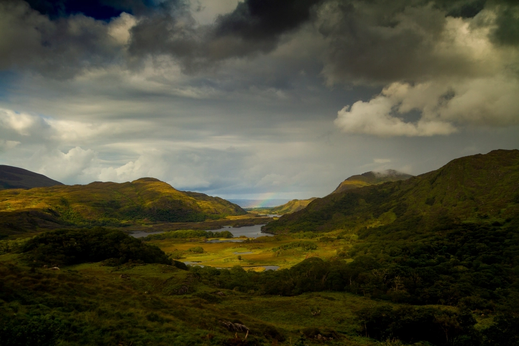
The Ring of Kerry, and how to drive it without hating it
The Ring of Kerry is a signposted circuit of the Iveragh Peninsula, the largest of the south-west’s headlands and the one that holds the highest mountains in Ireland. It is roughly a two-hundred-kilometre loop of coast road, mountain road and small towns, and it is the single most heavily marketed drive in the country. That marketing has consequences, most of them logistical, and knowing them in advance is the difference between a memorable day and six hours behind a coach.
Why direction matters more here than anywhere else
Tour coaches conventionally drive the Ring anticlockwise from Killarney — out through Killorglin and Glenbeigh along the north coast, round the western end at Waterville, and back along the southern shore through Sneem and Kenmare. The reason is simple: on the narrow sections the coaches keep to the inside of the bends and away from the drops.
What that means for a car driver is a straightforward choice with a real trade-off on each side.
- Go anticlockwise with the flow. You will never meet a coach head-on, but you may spend long stretches stuck behind one, and you will arrive at every major viewpoint at roughly the same time as everybody else who left Killarney when you did.
- Go clockwise against the flow. The road clears in front of you and the viewpoints empty out, but you will meet coaches coming the other way on narrow bends, and on the outside of them. Confident drivers manage this without drama; nervous ones should not attempt it.
- Or start early and dodge the question. The coach convoys leave Killarney in a fairly predictable window in the morning. Being on the road before them, in either direction, removes most of the problem for the first half of the day.
- Consider starting somewhere other than Killarney. Coming from Tralee you can join the loop at Killorglin, which puts you ahead of the Killarney departures without having to get up in the dark.
The parts worth stopping for
The Ring is often described as a scenic drive, which undersells the good bits and oversells the dull ones. A fair amount of the circuit is pleasant rather than remarkable, and the memorable sections are concentrated.
The north coast
From Killorglin the road runs along the southern shore of Dingle Bay with the Dingle Peninsula laid out across the water. Glenbeigh and Rossbeigh give you a long sand spit and a view straight up the bay. Just west of here the road climbs and the views open out substantially; this is the first stretch that justifies the reputation.
Cahersiveen is the main town of the western end and a sensible place to break for food. Just outside it, reached by a small road and a couple of bridges, sit two of the best-preserved stone ring forts in the region. They are free to visit, rarely busy, and give a far better sense of early Irish settlement than anything you will see from the main road.
The western end
The road round to Waterville and Caherdaniel is the most consistently good driving on the circuit. Waterville sits on a narrow strip between a lake and the sea. Above Caherdaniel, the Coomakista pass gives the view most people have in mind when they picture the Ring: the bay, the offshore rocks and, on a clear day, the Skelligs sitting far out on the horizon.
Derrynane, below Caherdaniel, is the best single stop on the whole loop and is regularly skipped because it is a couple of kilometres off the main road. It has a fine beach, a tidal island you can walk to when the sand is exposed, dunes, woodland, and the house of Daniel O’Connell, the nineteenth-century politician who did more than anyone to shape modern Irish democracy. Give it two hours if you can.
The southern shore
Sneem is a small, brightly painted village that most coaches stop at, and it is fine. Beyond it the road runs through woodland and rhododendron towards Kenmare, with the mountains of the Beara Peninsula across the water to the south. Kenmare itself is the most appealing town on the circuit — small, well kept, good places to eat — and is a better overnight base than Killarney if you are staying on the peninsula.
The Skellig Ring
Branching off the main circuit at the western end is a smaller loop called the Skellig Ring, running out through Portmagee and round Bolus Head, with a spur across the bridge to Valentia Island. It is narrower, rougher, and prohibited or impractical for large coaches, which is exactly what makes it worth doing.
The Skellig Ring gives you the closest mainland views of Skellig Michael and Little Skellig, the road over the Coomanaspig pass, the dark cliffs of Bolus, and Valentia with its slate quarry and its lighthouse. It adds a couple of hours to the day and it is, for most people, better than the equivalent stretch of the main Ring.
A word on the road
The road is genuinely narrow in places and involves some steep gradients with tight bends. If you are not comfortable reversing on a single-track road, this is not the section for you.
Does it deserve a whole day?
Honestly, it deserves either more than a day or less than the whole circuit. The full loop driven in one go, from Tralee, with the return leg included, is a long day in a car with a lot of windscreen time and not much walking. People finish it tired and with a slightly flat feeling, having seen a great deal and stopped properly nowhere.
Two better options exist. The first is to do it over two days with a night in Kenmare, Caherdaniel or Portmagee, which turns the drive into a proper journey and lets you walk at Derrynane and do the Skellig Ring without hurrying. The second is not to do the full loop at all: drive out from Tralee to the western end, spend the day between Cahersiveen, Valentia, Portmagee and Derrynane, and come back the way you came. You will have seen the best of the peninsula and skipped the least interesting third of the circuit.
If you have only one day and want the loop for its own sake, that is a legitimate choice. Just start early, accept that you will stop at perhaps four places rather than a dozen, and pick them in advance.
Practicalities that make a difference
- Fill the tank before you start. Fuel stations on the western end of the peninsula are sparse and some keep short hours out of season.
- Do not rely on mobile signal. Coverage is patchy through the mountains and along the western cliffs. Download maps before you leave.
- Take food with you. Between towns there is very little, and in the shoulder seasons some cafes and restaurants close entirely.
- Build in weather slack. Low cloud can remove the entire point of Coomakista or the Skellig Ring. If the morning is thick and the afternoon is forecast to clear, reverse your plan for the day.
Crowds, seasons and the honest picture
In July and August the Ring carries a great deal of traffic and the main viewpoint car parks fill. It is not unpleasant, but it is not solitude either, and anyone expecting an empty road round a wild peninsula will be disappointed. May, June and September are noticeably better, with long daylight and thinner traffic. October can be superb.
Out of season
Winter is a different proposition. The road is quiet and the light on a clear day is remarkable, but a great many businesses along the route close, daylight is short, and a wet, windy day on the Iveragh reduces the views to grey. Go anyway if you are staying nearby and the forecast is decent; do not plan a special trip round it in January.
Whatever the season, the thing that improves the Ring most is getting out of the car. Every one of the places worth remembering on this peninsula rewards half an hour on foot, and none of them are visible properly at fifty kilometres an hour through glass.